Geotagging
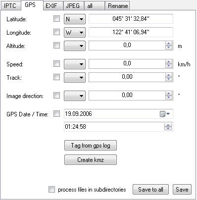
The GPS tab works like the IPTC tab. The GPS tags are display and you can edit and save them - using the checkboxes as descripted before.
You can import a GPS log from a GPS device. PTS compares the data from the GPS log with the EXIF tags from the digital camera and selects the nearest point. You can define an offset to balance bad synchronization between GPS and camera clock. (hint: take a picture of your GPS receiver showing the current time :-) ).
Kmz files are used by Google Earth and Google Maps to show custom information on the world map. PTS can create these files from geotagged photos. You can create kmz files for single photos, for selected photos in one directory or for a directory and its subdirectories. You can combine this function with GPS logs and thus show the route on the map.
GPS log format
To geotag photos, PTS reads NMEA logfiles recorded by a GPS device. I record the NMEA data with VisualGPSce on my Windows Mobile 2005 pocket PC but you can use any hard- and software that produce logfiles following the NMEA standart.
The current version of PTF only reads the GPRMC records of the NMEA logfile. So make sure these records are included to the logfile. Other records can omittied to save space.